Tracking the 2020 Atlantic Hurricane Season
The 2020 Atlantic hurricane season surpassed the record number of named storms forming across the basin set in 2005, the most of any year going back to at least 1851. We're tracking them here.
- Tropical cyclone
- Category:
- 1
- 2
- 3
- 4
- 5
Note: Forecasts are in your local time unless otherwise mentioned. Data as of
NOAA’s Climate Prediction Center forecasted between 19 and 25 named storms this year and up to 11 hurricanes—up to 6 of which could become major hurricanes. An average season only produces 12 named storms.
The most active Atlantic hurricane season on record was previously set in 2005, which also began relatively early and produced 28 storms—including Katrina.
Cumulative number of Atlantic storms per year, 1950-2020
As greenhouse gas emissions warm the earth, oceans are absorbing much of the excess heat, increasing the likelihood of more extreme weather events.
Analysis from Phil Klotzbach, a meteorologist at Colorado State University, shows that sea surface temperature anomalies in the tropical Atlantic are at their fourth highest levels on record. The three years that were warmer—2005, 2010 and 2017—all had extremely active hurricane seasons.
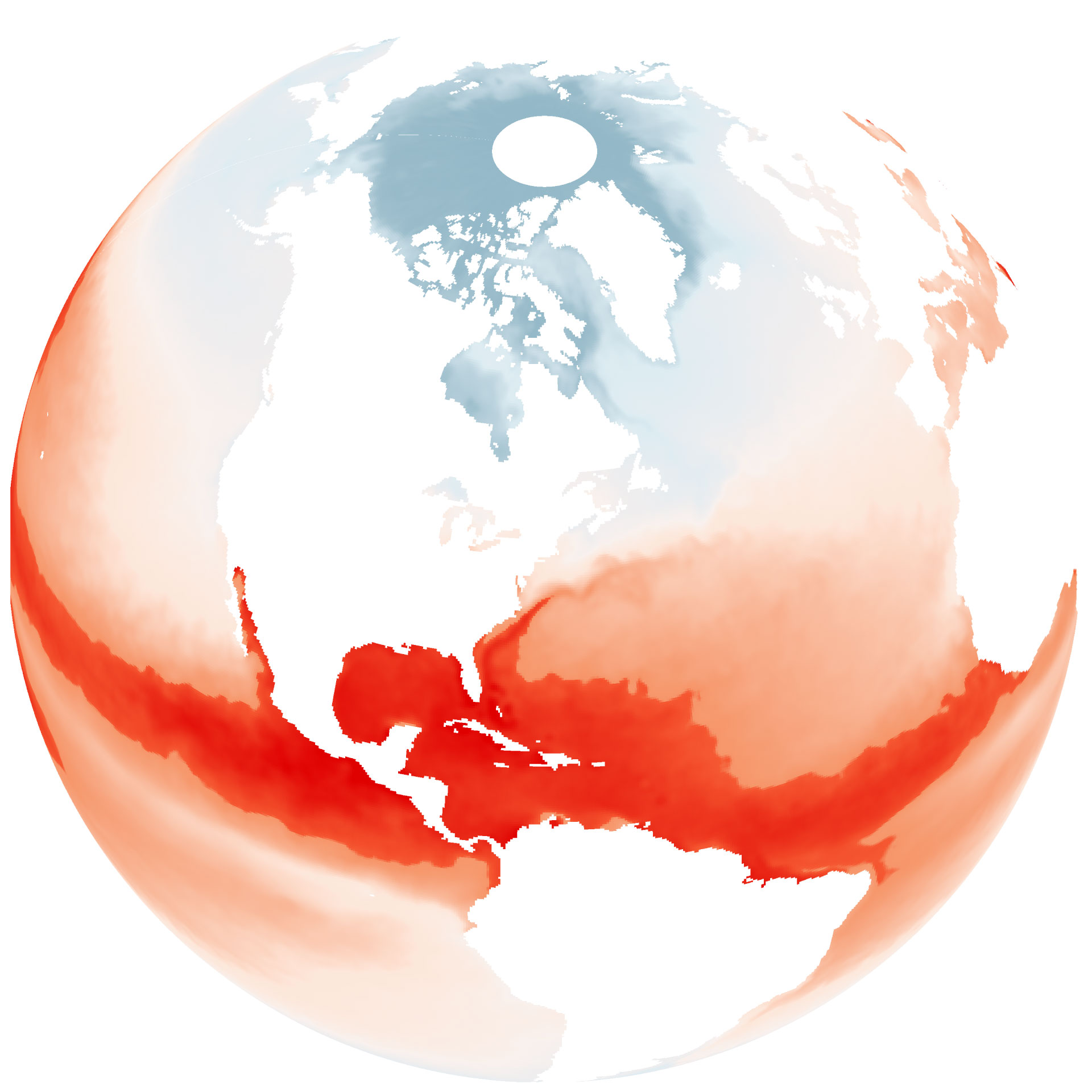
Average sea surface temperature
June 1—August 22, 2020

45°F
Sea surface temperatures at 82°F and above are necessary for tropical cyclones to form
56°F
79°F
81°F
82°F and up

45°F
Sea surface temperatures at 82°F and above are necessary for tropical cyclones to form
56°F
79°F
81°F
82°F
and up

Sea surface temperatures at 82°F and above are necessary for tropical cyclones to form
45°F
56°F
79°F
81°F
82°F
and up

45°F
56°F
79°F
77°F
Sea surface temperatures at 82°F and above are necessary for tropical cyclones to form
81°F
82°F and up
45°F
56°F
79°F
Sea surface temperatures at 82°F and above are necessary for tropical cyclones to form
77°F
81°F
82°F and up